Meet your summer fling: Hugo. Who needs an SO when you’ve got a spritz—equal parts soft and strong. Built on prosecco, kissed with elderflower and soda water, and cooled with mint, it’s your no-strings standby. Here, a handful of Hugos worth swooning over.
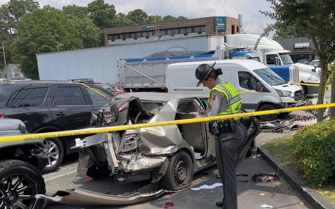
Raleigh already knows which intersections are most dangerous. The question is how quickly the City can redesign them before the next crash becomes another data point.
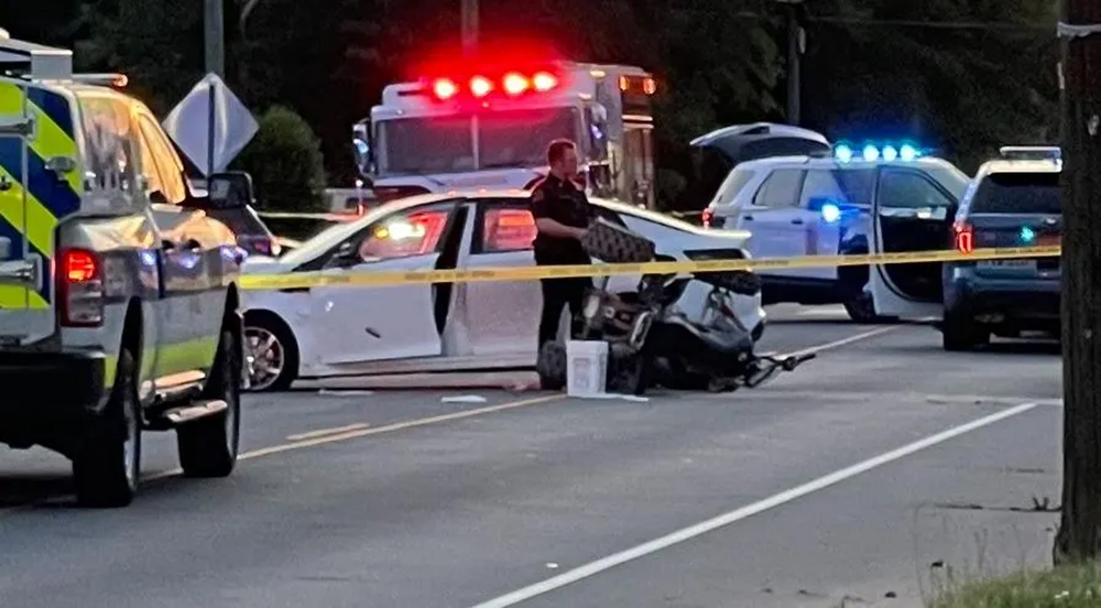
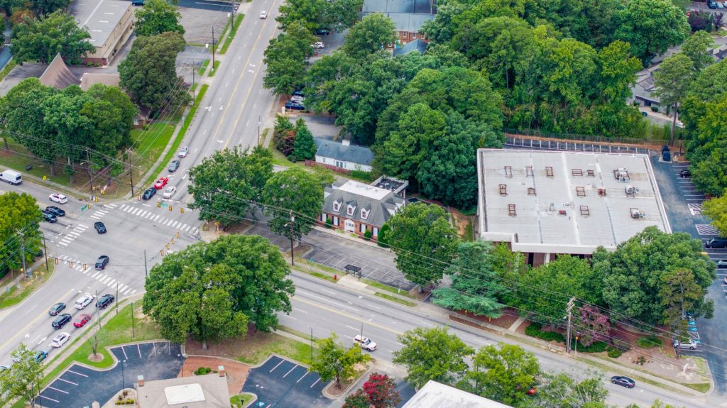
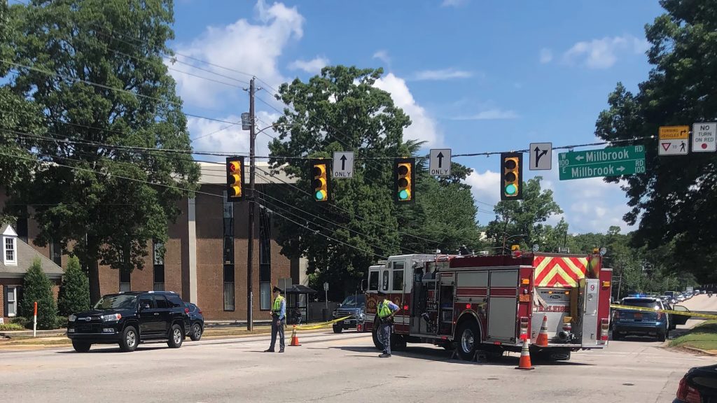
For pedestrians, Raleigh’s streets are a gamble. Six Forks and Millbrook. South Wilmington and East Davie. New Bern and Sunnybrook. These aren’t just intersections—they’re choke points.
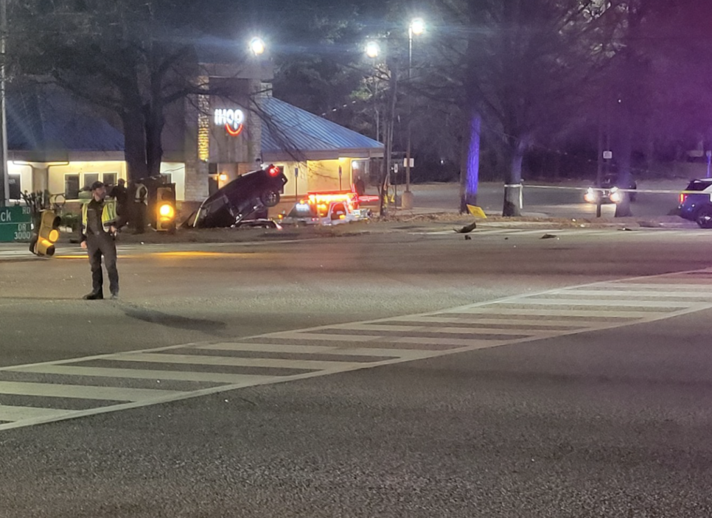
Now, for the first time, the City knows exactly where the danger is. Raleigh has formally mapped where severe crashes cluster. The newly finalized Comprehensive Safety Action Plan identifies the intersections where fatal and serious injury crashes happen most often—and outlines the infrastructure changes officials believe could prevent future deaths and injuries. But even the City admits the scale is massive.
DTR
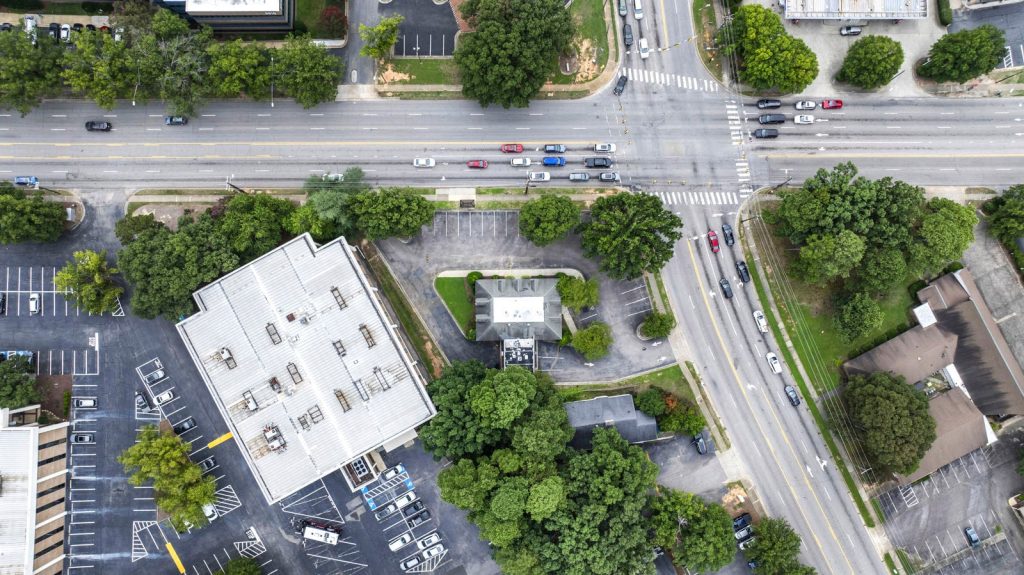
Of the city’s ~10,000 intersections, just 200 account for roughly half of all fatal and serious injury crashes. And while intersections like Six Forks and Millbrook, South Wilmington and East Davie, and New Bern and Sunnybrook rank among the city’s most dangerous for pedestrians, cyclists and scooters, Raleigh’s newly developed High Injury Intersection list makes clear the danger isn’t isolated to a few notorious crossroads.
This is not anecdotal—this is a decade of crash mapping. The City built a formula to pinpoint where risk clusters most heavily. Raleigh’s High Injury Intersections are defined not by fatalities alone, but by a combined crash score factoring in fatal, serious, moderate and minor injury crashes. For pedestrians and bicyclists, Raleigh used a separate 10-year dataset tracking all pedestrian-involved crashes regardless of severity.
It’s not random—it’s a formula. These wrecks happen in predictable places with predictable conditions. “Fast growth intensifies road safety challenges as travel patterns, traffic volumes and transportation modes evolve,” said Mayor Janet Cowell. Raleigh’s risk equation boils down to speed + sprawl + split attention. Heavy traffic volumes, high-speed roads, constant turning traffic, poor visibility and long crossing times all contribute to the danger. The pattern is remarkably consistent: multilane roads built for speed colliding with growing pedestrian activity, bus stops, commercial driveways and cars turning in every direction.
In many cases, the danger isn’t a single catastrophic design flaw—it’s cumulative friction: a fast-growing city layered onto infrastructure originally designed to move cars quickly, not necessarily people safely. “The City of Raleigh—both elected officials and staff—is committed to eliminating all fatal and serious injury traffic crashes and creating a safer, more resilient transportation network,” said Cowell, acknowledging their pledge to reduce traffic fatalities and injuries by 50% by the year 2040 and 100% by 2055.
CBRE
Beyond identifying where these crashes happen—the question is how fast the City can fix them. To address the problem, Raleigh is leaning into what transportation planners call the Federal Highway System’s “Safe System Approach”—a strategy focused less on perfect driver behavior and more on making roads themselves more forgiving when mistakes happen.
The strategy was formally presented to Raleigh City Council this spring as part of the City’s Comprehensive Safety Action Plan, which prioritizes projects based on crash severity, risk patterns and resident feedback.
In practice, that means protected left turns, high-visibility crosswalks, refuge islands, upgraded signal timing, curb bump-outs and lower DTR speed limits—as well as better signage on street signs, pavement markings and improved lighting. “A lot of accidents happen at night,” noted Cowell. “We can also increase things like the median so pedestrians have a safe place to stop in the middle of a really wide street.”
Projects are prioritized using more than crash history alone, says Vision Zero Program Manager Sean Driskill, including pedestrian volumes, feasibility, anticipated costs and overlap with infrastructure projects.
But redesigning dangerous intersections is rarely fast—or cheap. Many of Raleigh’s proposed improvements remain tied to larger corridor projects, state partnerships or funding mechanisms that could take years to materialize. “Roughly half of the top 200 High Injury Intersections have already had some level of safety improvement completed in recent years or planned as part of a future project,” says Driskill. Still, many remain conceptual, unfunded or tied to larger infrastructure efforts that could extend the timeline.
Since 2022, the City says it has improved roughly 40 intersections through signal upgrades, enhanced lighting, pavement markings and other safety measures. While “no single intervention has been identified as universally most effective,” says Driskill, “instead, improvements are tailored to the specific crash patterns and roadway conditions present at each location.”
In one recent successful example at Bland Road, Falls of Neuse Road and Pacific Drive, converting a southbound left turn to protected-only movement during certain times reduced total crashes by 38% and injury crashes by 83%, with serious injuries dropping from two to zero.
Raleigh doesn’t have a mystery on its hands. It has a map. The challenge now is how quickly the City can redesign its most dangerous roads before the next crash becomes another data point.
CBRE
How the City Built the Map
Raleigh’s crash rankings are based on years of traffic data—not just headlines.
Overall rankings use crash data collected between 2019–2023
Pedestrian and bicyclist rankings use a separate 10-year dataset (2014–2023)
Unlike the broader rankings, the pedestrian list includes all pedestrian-involved crashes—not just fatal or serious injuries
Rankings will be updated periodically as new crash data becomes available
CBS 17
Safety Playbook
Raleigh’s “Safe System Approach” focuses less on perfect drivers—and more on roads that leave less room for catastrophic mistakes. What the City is doing:
Protected left turns
High-visibility crosswalks
Median refuge islands
Signal timing changes
Curb bump-outs
Improved lighting
Bus stop relocation
Lower DTR speed limits
Danger Zones
Highest-risk intersections for pedestrians & cyclists—and what the City says it’s doing about them.
New Bern Ave. + Trawick Rd. New pedestrian crosswalk added; more upgrades tied to New Bern BRT corridor
Millbrook + Six Forks Rd. Pedestrian improvements planned through revised Six Forks Road Improvements project
Capital Blvd. + Calvary Dr. Crosswalks & lighting upgrades complete; redesign plans include bus stop relocations, intersection geometry & median fencing
Capital & Crabtree Blvd. Signal timing changes in place; broader pedestrian safety overhaul in development
New Bern Ave + Hill St. + Sunbury St. Planned upgrades alongside BRT project
New Bern Ave. + Shanta Dr + Sunnybrook Rd Safety improvements tied to future BRT construction
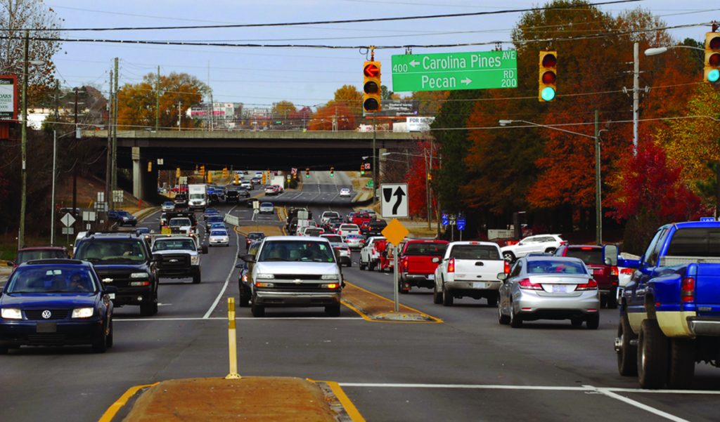
South Saunders St. + Pecan Rd. + Carolina Pines Ave. Seeking federal funding through Safe Streets for All Implementation grant application
Kent Rd + Method Rd + Western Blvd Signal upgrades complete; new pedestrian crosswalk planned after nearby I-440 work wraps
GlenwoodAve. + Brier Creek Pkwy. Future upgrades planned through NCDOT’s broader US-70 improvement project
The Raleigh Commons
Where Speed Wins
These intersections rank among Raleigh’s most dangerous overall for all modes, where speed and volume collide—literally.
S. Wilmington St. + Tryon Rd. Planned upgrades include high-visibility crosswalks, signal timing improvements, curb bump-outs & sidewalk gap fixes
New Bern Ave. + Trawick Rd. New pedestrian crosswalk installed; additional upgrades coming in conjunction with BRT corridor.
Capital Blvd. + Huntleigh Dr. Backplates, signal timing upgrades, new concrete curb ramps, additional signal heads & signal hardware upgrades planned through NCDOT partnership
CBS17
Capital Blvd. + Calvary Dr. Crosswalks & lighting upgrades complete; redesign plans include bus stop relocations, intersection geometry & median fencing
Poole Rd. + Rose Ln. Conceptual redesign complete; City exploring funding options
Forestville + Louisburg Rd. Converted into “Reduced Conflict Intersection” designed to limit dangerous turning movements, plus pedestrian crossing across Louisburg Rd.
Hammond Rd. + Rush St. Planned improvements include new pedestrian crossings, signal timing upgrades, backplates & additional signal heads
Saunders St. + Ileagnes Rd. Seeking federal funding through Safe Streets for All Implementation grant application
Glenwood Ave. + Brier Creek Pkwy. Future upgrades tied to NCDOT’s US-70 Improvement Project
Martin Luther King Jr. Blvd. + S.Salisbury + S. Wilmington St. Improvements planned as part of an NCDOT Spot Mobility Project
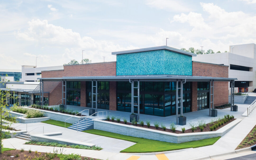
Enter The Granite Grill, an upscale-casual concept from the brains behind Village District’s Tazza Kitchen. Now more than a decade deep in Raleigh, Big Kitchen Hospitality is doubling down on what works—polished but approachable neighborhood-first spots that feel as much trusty default as they do destination.
West Raleigh’s next dining play isn’t just another tasty opening—it’s a signal. On the heels of Crooked Hammock’s splashy debut, GlenLake’s momentum keeps building, with another anchor aimed squarely at turning this pocket (where Creedmoor becomes Edwards Mill) into a true work-stay-play zone.
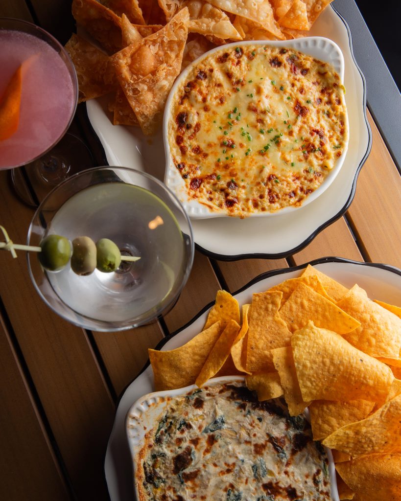
Set just across from the Hammock, The Granite leans classic in both vibe and menu in a space big enough to signal scale: comfy booths, lively bar and a patio built for lingering over steaks, seafood and burgers—plus a cocktail list built on the OG hits (martinis, old-fashioneds and margs among them).
“We share in the continued interest and buzz around West Raleigh,” says partner John Davenport, pointing to neighbors like the Hammock, Wong’s Tacos and upcoming Jeff’s Bagel Run.
That buzz isn’t accidental. Highwoods Properties has been quietly stacking pieces here—and thinking bigger. “By intentionally crafting environments and experiences… we continue to build a truly commute-worthy destination,” says SVP and Raleigh Market Leader Skip Hill.
In other words, GlenLake isn’t just filling in—it’s taking shape. Zoom out and the play becomes even clearer. With the Blue Ridge Corridor’s long-term glow-up on deck and the upcoming Raleigh Sports and Entertainment District surrounding Lenovo and Carter-Finley, the swath of West Raleigh is gearing up for a full-on identity shift.
“This addition strengthens GlenLake, where dining, work and gathering spaces make us all better together,” says Hill. Call it curated, call it progress—the takeaway’s simple: This is how a district unfolds.
Raleigh is one of the safest cities in the nation—full stop. But zoom in, and that reality starts to splinter.
Because over a 10-day stretch this April, a cluster of violent crimes cut across the city—from DTR to North Raleigh to the northeast and southeast corridors—turning what is statistically rare into something that felt anything but. A knife fight on Fayetteville Street, multiple shootings, a homicide—different neighborhoods, same throughline: escalation.
And that’s the tension city leaders are now confronting head-on. Following the surge, Raleigh Police Chief Rico Boyce stepped to the mic with a message that cut through the usual talking points: Rankings don’t reassure people who just watched violence unfold in real time. “Recent incidents have impacted the sense of security in our community,” he said. “And that is not acceptable.”
He’s right—and the data backs him up in a complicated way. According to first-quarter figures released by RPD, overall crime is down compared to this time last year—a continuation of a broader trend that consistently places Raleigh among the safest large cities and state capitals in the country.
Raleigh is safe on paper. April challenged that in practice. Because here’s the catch: Numbers don’t always tell the full story. They measure volume—not impact. And they don’t capture clustering, visibility or how quickly a handful of high-profile incidents can reshape perception.
A single shooting in a North Raleigh grocery lot is a statistic. When it’s one of three in a week—across all sects of the city—it risks being a pattern people can feel. That distinction matters. Because public safety isn’t just about long-term trends. It’s about whether people feel secure walking to their car, leaving the bar or letting a night stretch a little longer.
Boyce acknowledged as much, all but directly stating that clusters like this can be a slippery slope if left unchecked. His focus now: making sure April reads as an anomaly—not a preview.
Already this year, RPD has removed 474 illegally possessed guns from the streets—a figure the department points to as both progress and proof of the scale of the issue. Next steps are more targeted.
Downtown and nightlife corridors are getting increased attention, with expanded partnerships between the police, Alcohol Law Enforcement and Wake County ABC, including heavier presence where foot traffic—and risk—runs highest: bars, clubs, transportation hubs and key hospitality zones.
At the same time, the department is doubling down on prevention, working with small businesses, youth organizations and community groups to interrupt problems before they escalate. Because, as Boyce put it bluntly: “Policing alone cannot solve this challenge. … We are part of this community, just as this community is part of us.”
Translation: This only works if everyone’s in it and invested. Which brings the ask back to residents—especially as the city heads into high-traffic summer months. Stay alert, he implores—and if you see something, say something. Call 911 when something feels like it’s turning. Those moments, the ones that seem small, are often where escalation begins.
“Violence escalates from moments that could have been interrupted,” he says. “That call could be the difference between prevention and tragedy.”
The numbers may be trending in the right direction. But right now, Raleigh is being reminded of something less quantifiable—and more immediate. Safety isn’t just a measure. It’s felt. Promises Boyce: “When we stand together, we are stronger and more effective.”
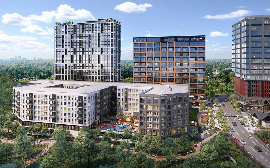
First up: 207-unit Veranda, bringing 55-plus housing to the district, followed by seven-story, 387-unit residential-retail newcomer Merit. Also fueling NHID’s bleisure (read: business + leisure) era is upcoming 20-story residential tower Vesper with rooftop pool and amenity deck; a 200-plus-key hotel with potential rooftop bar and street-level restaurant; and a new office tower with activated ground-level space. And with access front of mind, Kane is also eyeing a Church at North Hills Street extension, plus a car/pedestrian bridge connecting Navaho Drive—all designed to align with future greenway expansions and planned multimodal bridge over the Beltline.